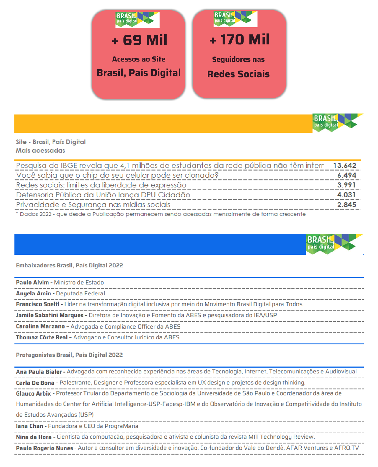
During the events MundoGeo Connect 2019 and Drone Show, which take place from June 25th to 27th at the Frei Caneca Convention Center, the final result of the contest GeoSampa Hackathon 2019. The hackathon has the institutional support of ABES and is a marathon for the development of analysis, planning and management tools, applications for smartphones, tablets, among others, using data from GeoSampa – Geographic Information Portal of the City of São Paulo.
The challenge given to the participants, who enrolled in the first selection stage, was to present projects that facilitate and improve the lives of the citizens of the city of São Paulo.
The works received were evaluated in five categories: Public interest, Participatory monitoring, Creativity, Sustainability and Technical quality. The finalists are:
– Discovering and mapping typographic diversity in São Paulo: in search of collective intelligence in the spontaneous city through 'BigData' made available by GeoSampa, presented by Fernando Gomes – Centro Universitário Belas Artes de São Paulo
– GeoSampa static file distribution model, developed by Thomas Len Yuba – São Paulo Urbanismo
– Uncovered Rivers – The rescue of the city's waters, presented by Alexandre Sahade Goncalves – Estúdio Laborg
The big winner will be announced on June 27, in a ceremony scheduled for 14:00. During this day, several activities will take place at Espaço Geosampa from 9:30 am, which will bring together public managers, experienced professionals and new talents in the area of technology and information management, aiming to qualify the debate for proposing solutions for a smart, open city and connected.
Drone Show and MundoGeo Connect 2019
June 25th to 27th (Tuesday to Thursday)
10 am to 7:30 pm
Frei Caneca Convention Center – Rua Frei Caneca, 569 – Consolação Information: www.droneshowla.com